

- Email link
- Read comments (2)
- Share:


Historical society travels old Bloomfield Road
Part One of our amazing journey:
I can't remember what year I first joined the Stoddard County Historical Society (membership--$5.00 a year), but I know we've discussed the old Bloomfield Road more times than I can possibly recall.
In fact, when it comes to the history of this region of Southeast Missouri, everything leads back to the old road from Cape to Bloomfield.
This is Part One of the story of our journey.
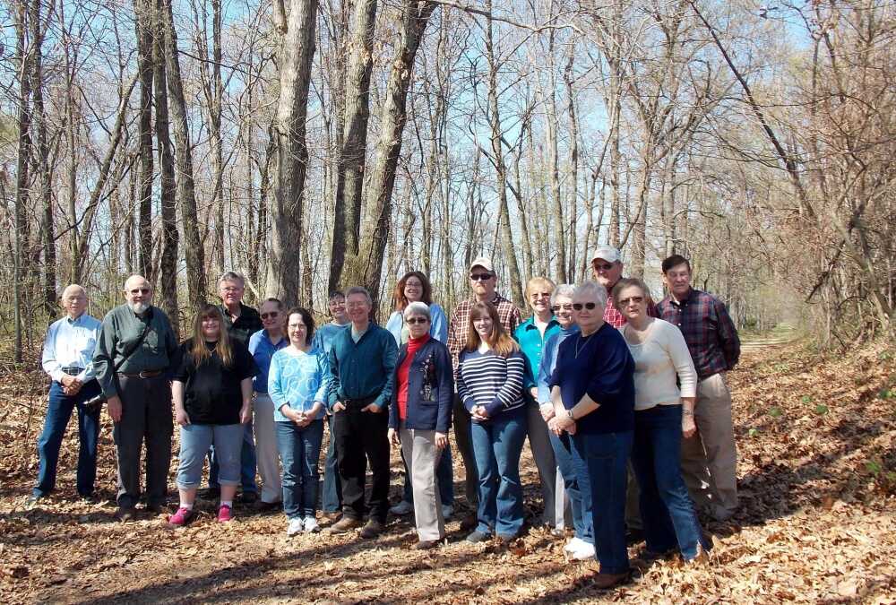
Our bus left from the Stars and Stripes Museum in Bloomfield at 9 a.m. Saturday, April 13, 2013. It was a trip we had longed to take for at least three years, but we had begun to think we would never see that day come.
Nineteen members of the Stoddard County Historical Society and interested guests boarded a cramped First Student "short bus" to travel back in time along the old Bloomfield-to-Cape Road (or Cape to Bloomfield Road, depending upon your point of view).
Our guides were the essential part of this operation. It had taken three years for us to acquire the date and the local historians willing to direct us on this tour over a historical road which no longer exists.
Few residents of southeast Missouri realize the importance of the "Old Road," which carried both Union and Confederate soldiers during the Civil War in 1861-1865. Bloody battles were fought on this road, and lives were lost. As the capital of a southern county, Bloomfield was in the middle of that uniquely American conflict.
As time goes by, fewer and fewer historians remain to tell us the story of what happened during that era of our nation's struggle.
Fortunately for the historical society, Dr. Nickell, director of the Center for regional History at Southeast Missouri State University and Dr. Bill Shell, local historian, teamed up with our own historian, Jim Mayo, to take us on a magic carpet ride across 30-plus miles of nearly forgotten history.
From Bloomfield north to Cape Girardeau, the road is called the "Bloomfield Road;" from Bloomfield south, this route is known as the "Chalk Bluff Road."
"Bloomfield is special, because it has so much history," explained Dr. Nickell."Jim Mayo and the Historical Society have put up historical markers to guide people in their study of the past. This makes Bloomfield unique; not many towns are so well-documented."
Our guided tour started at the old Miller House, where our three historians described the battles which took place at that site. Mayo gave the background on Henry Miller, who built the house in 1850 and was responsible for the first school. He told of Miller's bravery in going to get his son, when he was wounded.
Dr. Shell had done the homework for the tour, creating a map of the old road and contacting the landowners to get permission to bring the bus on their land. In many places, the road came to a dead end in a field, and our talented bus driver had to back up in the mud.
Wherever we went, we attracted attention from the locals, most of whom had never seen a school bus in those locations. On one narrow Cape street in front of Fort D, our bus driver had to squeeze the bus between rows of parked cars. She received a round of applause from a family eating lunch in their front yard.
We soon learned that the term for an old, abandoned road is a "swale." Most of us had seen these ditch-like formations and had wondered how they were formed. There are hundreds of "swales" throughout the county, as the roads are constantly changing through the years.
"The landscape speaks to us," Dr. Nickell explained.
Before the draining of the swamps, roads had to keep to the top of the ridges. These paths were used by both animals and Native Americans, before the first settlers crossed the Mississippi at New Madrid.
According to our guides, the first wagons were small, often two-wheeled carts. The Union Army brought in the first large wagons.
Dr. Nickell explains to our group that there are three different routes between Advance and Bloomfield: There is the "new" Highway 25, built in the 1940's; there is Old 25, which is gravel and is now labeled CR 307; and there is the Cape to Bloomfield Road, which is now labeled CR 317. It is not possible to follow this road in all places, but it goes to the old extinct community of Piketon and follows the ridge through the hills on CR 309 to Tillman, where Pleasant Hill Church is still standing.
Stay tuned, as our trip continues in the next installment.
- Email link
- Read comments (2)
- Share:
Comments
-
-- Posted by goat lady on Sun, Apr 21, 2013, at 5:53 AM
-
-- Posted by Dexterite1 on Sun, Apr 21, 2013, at 6:14 AM
Respond to this blog
Posting a comment requires free registration:
- If you already have an account, follow this link to login
- Otherwise, follow this link to register